A new foldable map, created by GRID-Arendal as part of the Nunataryuk project, shows the distribution of permafrost extent around the world, both on land and under the seabed. It’s designed as a Dymaxion map, presented in two dimensions and intended to be folded into a globe.
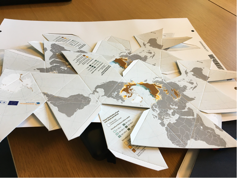
GRID-Arendal GIS expert Georgios Fylakis designed the map. The data were drawn from two 2019 research papers: a paper whose lead author was Paul Overduin, a co-coordinator of the Nunataryuk project and a senior scientist at the Alfred Wegener Institute, Helmholtz Centre for Polar and Marine Research, and another paper whose lead author was Jaroslav Obu, a researcher at the University of Oslo.
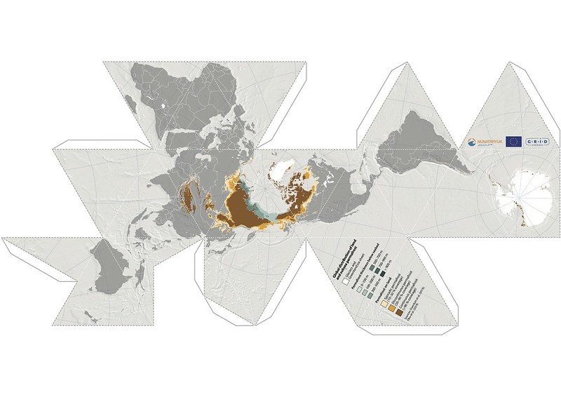
You can downloand the map here.
Below you find instructions on how to fold the map.
Dymaxion permafrost map from GRID-Arendal on Vimeo.